Logbook Days 51, 52,
and 53
6/30/2004 - 7/02/2004
Princess Louisa
40 miles up at the end of Jervis Inlet, behind the tidal
Malibu Rapids lies Princess Louisa Inlet with Chatterbox Falls at it's
head. We spent three nights surrounded by mile high vertical
cliffs ringed with waterfalls.
6/30/2004
Duncan's Cove to Princess Louisa Inlet
We checked out and left Duncan's at 11:00am once we completed the final
loading, mainly the coolers with fresh ice. We
exited the harbor and went north around into Agamemnon channel. We
needed to make up some time so we ran at 7-8 knots. We arrived in
Egmont on Sechet inlet at 12:30pm and had to wait for dock space to get fuel. I
didn't like towing the dinghy with the motor on, so we manually lifted it
off and put it back on the transom bracket while doing an impressive
balancing act.
We left a bit after 1:00pm
for Jervis inlet. The inlet is 40 miles long and averages a mile
wide over this length, it's a classic fiord. We are running at 3500 rpm and getting 7-8 knots
with the flood current. The wind and seas build from astern down
the open reaches of the arms no matter which direction we are heading.
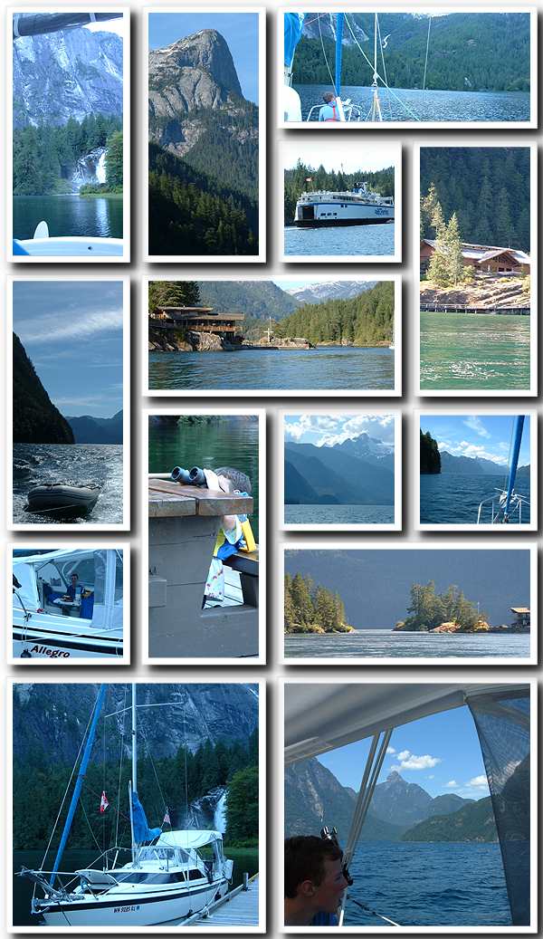
Once we entered Prince of Wales reach we were in awe of the gorgeous
scenery. The surrounding mountains are 4,000 to 6,000 feet tall
and fall steeply directly from their peaks to the water. Amazingly
fir trees somehow manage to cling to their sheer rock faces clothing
them in a coat of dark green. Our depth sounder poops out around
300'. Sam wanted to know how deep it was so we zoomed in on the
chart, at that moment we were passing over an area marked 659 METERS.
The average depth the whole length is over 500 meters. The walls
are as straight up and down below the water as above.
We got 17
miles on the first fuel tank. The gas ran out and the motor died in a rough area while Dawn
was driving down Princess Royal reach and I was setting up the laptop for a movie. We
switched the tank, and because we were now a bit early we ran at 6-7 at 2500
rpm for the last bit around Patrick Point and along a calmer Queens
Reach to the Malibu entrance.
I tried to switch
settings on the Pocket PC / GPS right at the entrance shutting off my
digital book on tape and ended up crashing windows as I was trying to
get a better look at the entrance chart. I had to turn away and
circle back. With out a chart and never having been there before
it was hard to spot the entrance. Since we had no chart
at the moment we just waited and followed the next boat up through the
dog leg Malibu Rapids. Now that I've seen it, there is no
problem. The Young Life Camp Malibu is perched on the rocks along
the north side of the rapids. Their pool is built into the rock
along the very edge of the pass. We cruised up the inlet in
silence and wonder at the hidden jewel tucked in at the end of the
fiord. Five miles in at the end of the inlet it's a dogleg turn to
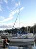
port and we pulled up to the dock at the falls,
tying up on the inside next to two other sailboats.
Shortly after
that, two large powerboats came in and parked on each side in front of us
blocking our view. I walked down the dock to take a look and
decided there was just enough room for us between the last boat and the
seaplane area at the head of the dock. No offense to our brethren
sailboats, but we moved around and parked
with our stern facing the falls with a unobstructed view from the
cockpit. This turned out to be a great spot to spend the night.
7/1/2004
Princess Louisa Inlet
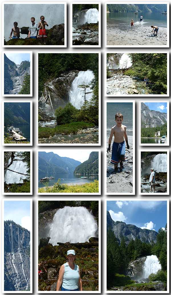
We woke late to a warm morning. Dawn went for a walk
and Sam and I made pancakes. We then all headed to Chatterbox
falls and took lots of pictures. The boys played in the river at
the base of the falls and Dawn and I just wandered around and marveled
at the sights. Just to the west of the steep valley the Chatterbox
falls river tumbles down is a vertical rock cliff over a mile high.
The cliffs on the east are nearly as steep as well and every time you look
you find another waterfall plunging down the face that you hadn't seen
before.
Dawn brought up lunch to a picnic
table and everyone took a break. The tide was very low and the mud was a magnet for the
boys. Once dirty even the rushing river wouldn't wash the sticky
stuff off.
Dawn and I decided to move the boat to a position anchored out at the
base of the falls river as we have had enough of dock life. We
motored out and set the Claw. When we first stopped our forward motion, it looked too shallow and
close in so I waited a bit as we backed for about 10' of water before I
let the anchor down. When we finished backing down we ended up
pulling it off the shelf into the 100' deep water. We went in a
second time and I set the hook in 5' of water.
It bit well there and we were parked to the left and well inside all the
other anchored boats. We're quite near shore, but the flow from
the falls river holds us in position facing the shore. The falls are just partly obscured behind
some thin trees. We have a great view of the high falls.
This is such an elegant way to park the boat.
We put the dinghy motor on and went in to the kids.
We picked up Mike and let him drive the dinghy around to other
waterfalls that are running right down directly into the inlet.
You can drive the dinghy right in under them and get a cool shower.
We then dropped Mike back on shore to play in the sand with Nick and,
Sam and I went out for a spin as he was dying to drive the dinghy.
Once back we had to get Nick and Mike at the seaplane dock as they had
been chased off the beach by the rising tide. Dawn and I had a
nice pasta dinner sitting alone on the bow facing the falls. We
also had good conversation with a couple of the neighbors who stopped by
in their dinghies. This was followed by a card game night of
international rummy
before we tucked in.
7/2/2004
Princess Louisa Inlet
It started to rain early in the morning and rained off and on through
lunch. The clouds were also very low. It was actually a nice
change after so many sunny days to have our first rain. The inlet
seems very mysterious cloaked in the low wispy clouds.
Our anchor is set
in the stream bed and is now high and dry on the low tide. I went in and
checked it and added some seizing to the shackle at the rope eye.
I stopped by "Havis Amanda" on the way back to chat and they invited us to a spaghetti
feed at 6pm. We had a nice Omelet brunch, then we all went to shore.
The sand beach is being cut away by the river current at the low tide
and was
too attractive for the boys. Mike proceeded to stand on the edge and
have it collapse beneath him tossing him into the water up to his chest.
We went up to the hut to try and clean him up, but it was a lost cause.
I went back to the boat for new clothes. Once he changed, Dawn and
the boys headed off for a hike on the trappers cabin trail while I
cleaned up the boat. The rain has stopped.
I picked them all
up and we got ready for our dinner engagement. We dinghy'd
over to Mary and Gifford Jones' 38' Nauticat. From when we arrived,
and Giff helped with our lines, we have enjoyed meeting the Jones'.
When they saw us they were reminded of a treasured cruising book, "The
Curve of Time" by M. Wylie Blanchet. It is the story of a widowed
woman who spent many summers cruising the British Columbia inside
passage with her 5 children in a 25' boat during the late 1920's.
They were nice enough to lend us their copy for us to look at.
We'd talked more a number of times and were thrilled to be invited to
their boat, also now anchored out at the base of the falls, for dinner. The kids enjoyed the
new space and we had great food and conversation.
We dinghy'd back
around 10:00pm. I put the motor on the transom and made other
preparations for our early departure in the morning. It rained
some during the night and I didn't get much sleep in anticipation of our
5am wake up call.
Next Page |